Hurricane Helene Updates
City of Hendersonville Storm Sweep
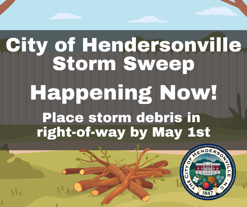
The City of Hendersonville has launched a Storm Sweep for Final Hurricane Helene Debris Cleanup. This final push aims to clear remaining Hurricane Helene debris in Hendersonville.
May 1 is the final day to place storm debris in the right-of-way for collection within the city limits.
Crews are conducting a final sweep to complete debris collection in the municipality.
What is the Storm Sweep?
The Storm Sweep is the City of Hendersonville’s final push to get Hurricane Helene storm debris cleaned up within the city limits. Debris cleanup is a massive undertaking that takes collaboration from the entire community to achieve.
What items will be collected and how should they be sorted?
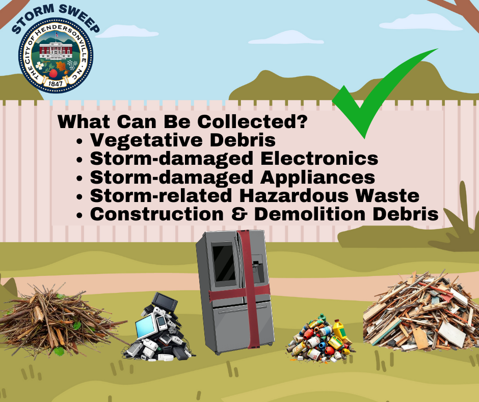
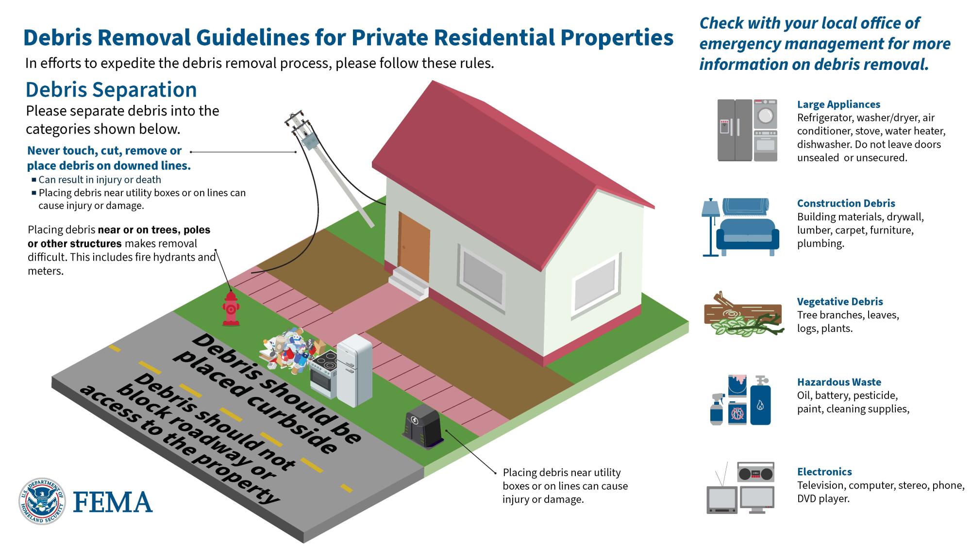
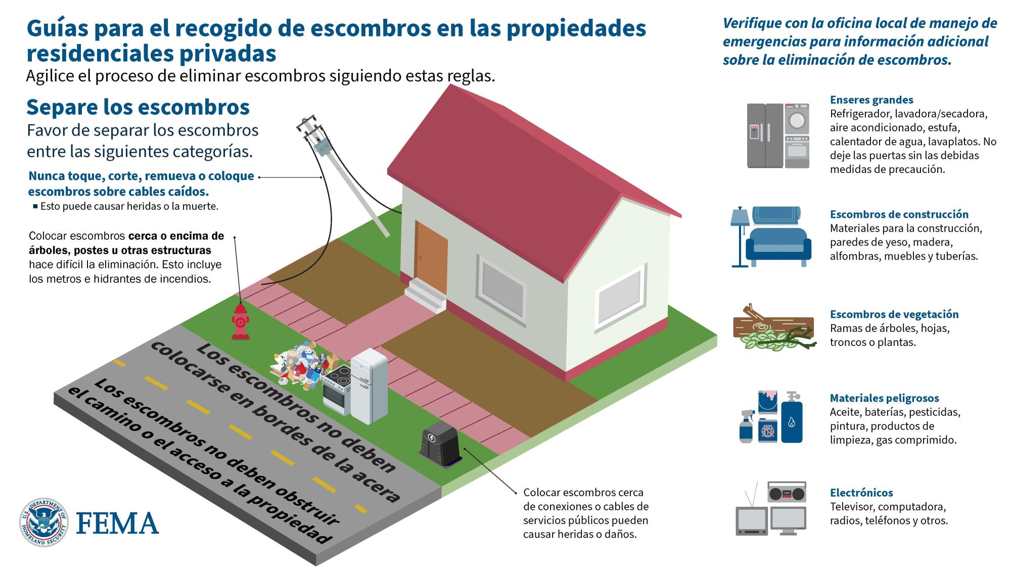
Hurricane Helene-related storm debris will be picked up during the Storm Sweep. The following debris is able to be collected if placed correctly in the right-of-way.
- Vegetative Debris – Tree limbs, logs, and branches. (Large trees and root balls requiring specialized equipment will be handled by Henderson County’s contractors.)
- Construction & Demolition Debris (C&D) – Building materials, drywall, lumber, carpet, furniture, roofing, plumbing.
- Storm-related Household Hazardous Waste – Paint, oil, batteries, chemicals, cleaning supplies.
- Storm-damaged Electronics – TVs, computers, DVD players, stereos, phones.
- Storm-damaged Appliances – Refrigerators, washers, dryers, air conditioners, stoves, water heaters, dishwashers. Appliance doors must be secured.
Where should I place storm debris?
- Only Hurricane Helene-related storm debris will be collected.
- Do not bag storm debris – leave it loose for collection.
- Keep piles at least five feet away from hydrants, utility poles, meter boxes, sewer clean-outs, mailboxes, garbage carts, or structures.
- Avoid placing debris directly under trees, power lines, or in areas that may obstruct collection vehicles.
- Storm debris should be placed in the right-of-way within ten feet of the roadside.
- Do not place debris where it could wash into waterways or storm drains.
- Regular household garbage and recyclables should go in the usual carts for routine collection.
- Non-storm vegetative yard waste collection may be delayed during the storm sweep.
When is the deadline for City of Hendersonville residents?
Sorted storm debris must be placed in the right-of-way by May 1 to ensure collection by the City of Hendersonville. Debris set out after this deadline will be the property owner's responsibility to dispose of and may be subject to code enforcement action.
Who is responsible for storm debris cleanup?
Debris cleanup following a hurricane is a coordinated effort involving multiple entities.
Private property owners are ultimately responsible for debris on their own property, although they can receive support through insurance and federal assistance from FEMA. Learn more about private property debris removal.
Henderson County is coordinating county-wide storm debris collection from the right-of-way for the unincorporated areas and municipalities. Learn more about Henderson County storm debris clean up. The City of Hendersonville Public Works Department has provided ongoing vegetative debris removal in Hendersonville and will deploy additional resources to collect final debris. The Storm Sweep is a program led by the City of Hendersonville to expedite final debris removal within the city limits.
Debris & Litter Resources
General Henderson County Storm Debris Collection Information:
https://www.hendersoncountync.gov/em/page/debris-removal
Private Property Debris Removal Program:
https://www.hendersoncountync.gov/em/page/private-property-debris-removal-program
Henderson County Disaster Recovery Center:
https://www.hendersoncountync.gov/em/page/disaster-recovery-center
HOA & Neighborhood Leaders
HOA and Neighborhood Leaders can sign up to receive updates:
https://publicinput.com/leader
FEMA Resources
Apply for Disaster Assistance: https://www.disasterassistance.gov/ or by calling 800-621-3362
The Henderson County Disaster Recovery Center (DRC) is in the Blue Ridge Commons Shopping Center at 2111 Asheville Highway, Hendersonville NC 28791.
City Permitting & Floodplain Information
City of Hendersonville Planning Department
- Issuing Zoning Compliance Permits from City Hall (160 6th Avenue East)
- Zoning Compliance Permits are Required for repair and rebuilding, fees are waived for storm-impacted properties. This ensures compliance with all Floodplain and Zoning Ordinance requirements.
- Zoning Compliance Permit Applications, when complete, can typically be reviewed and permits are issued within 24 hours for repair and rebuilding projects. Lengthier approval timeframes may be triggered when properties are required to meet components of the floodplain ordinance.
- Customer Service Hours at City Hall are 9 am to 5 pm
- Actively reviewing ordinances that have placed an undue burden on the recovery effort. These include an effort to allow Recreational Vehicles for “temporary housing” and for reconstructing “non-conforming residential structures” damaged in the storm.
- Working Closely with our county partners to identify heavily impacted areas and inform and guide the Federal Response.
City of Hendersonville Floodplain Administration
- Issuing Floodplain Development Permits
- Application link: https://www.cognitoforms.com/CityOfHendersonville4/FloodplainDevelopmentPermitApplication
- Floodplain development permit required for any development within the City Limits/ETJ in the Special Flood Hazard Area
- Fees currently waived
- Development includes: any manmade change to improved or unimproved real estate, including, but not limited to, buildings or other structures, mining, dredging, filling, grading, paving, excavation or drilling operations, or storage of equipment or materials.
- Work within mapped floodways will require a No-rise certification from a licensed engineer.
- Substantial Damage: damage of any origin sustained by a structure during any one-year period whereby the cost of restoring the structure to its before damaged condition would equal or exceed 50 percent of the market value of the structure before the damage occurred.
- Any structure that was deemed substantially damaged must be brought into compliance with the current flood damage protection standards adopted by the city.
- Coordinating with residents and NCEM on Hazard Mitigation Grant Program
- 51 Applications received during December open house (Acquisition and Elevation)
- Coordinating with County to ensure all applications are received ASAP
- Coordinating with State Technical experts and City Staff to develop recommendations to enhance flood protection standards and create a more resilient community.
State of Emergency
A State of Emergency remains is in effect in Hendersonville due to Hurricane Helene.
Debris Collection
No Burning
- Open burning is prohibited in the city limits at all times. That includes the burning of storm debris
Leaf Collection
- Bulk leaf collection started on December 2, 2024 with a modified collection schedule. Leaf collection will be slower than previous years due to resources still being dedicated to debris collection and storm clean up.
- Leaves should be placed in separate piles from brush and vegetative debris.
Debris Removal:
The City of Hendersonville Public Works Department wants to share information provided by Henderson County who is managing the construction and storm debris collection for all Henderson County residents, including City of Hendersonville residents.
- Henderson County will pick up all storm debris for free that is pushed to the right of way on DOT, municipal and private roads.
- Please fill out this debris reporting form to help the County better assess debris pickup needs.
- Henderson County has asked for patience as storm debris collection following the impacts of Helene is a tremendous undertaking. They are committed to continuing work until all storm debris is removed and have shared that if they have missed picking up debris on residents’ right of way, they will return.
- Henderson County Engineer Marcus Jones provided an update on storm debris collection at https://vimeo.com/1021871227
- Additional updates from Henderson County are available at www.hendersoncountync.gov/helene
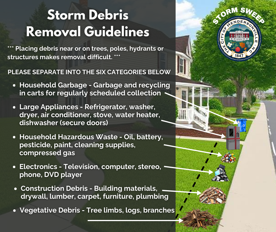
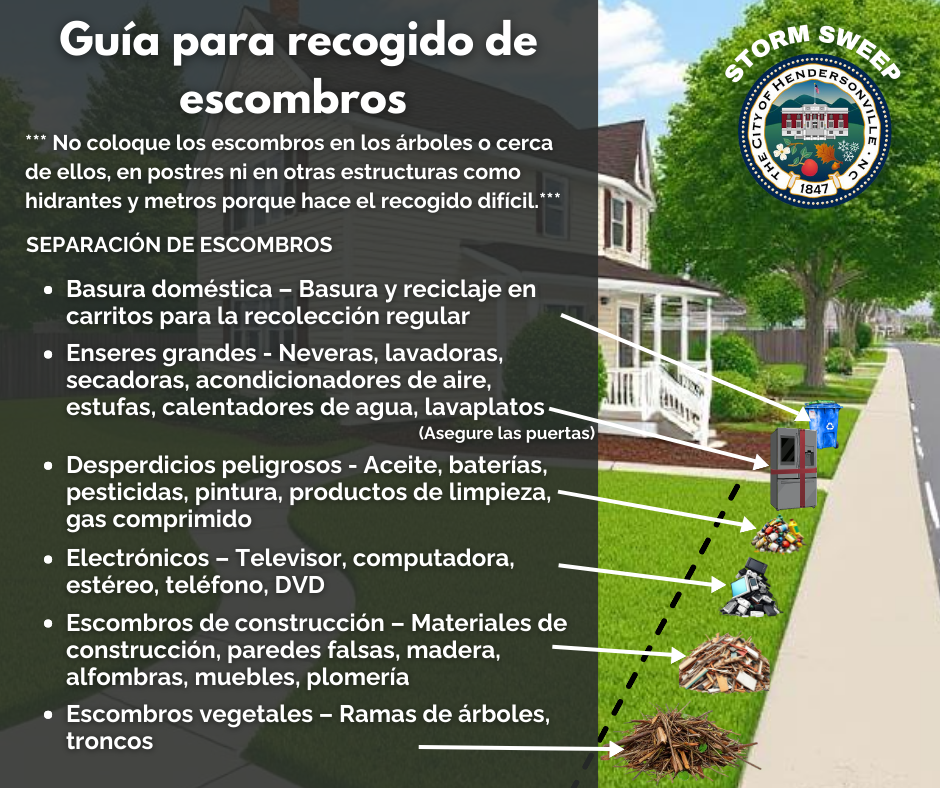
When piling storm debris at the curb, please follow these guidelines to ensure safe and efficient removal:
Separate debris into categories:
- Vegetative Debris: Includes tree limbs, and other vegetative debris.
- Starting December 2, 2024, City of Hendersonville customers should pile leaves separately for bulk leaf collection.
- Construction & Demolition Debris: Items like building materials, furniture, and carpets.
- Large Appliances: Damaged refrigerators, dishwashers, stoves, etc. (secure doors).
- Electronics: Damaged TVs, computers, and other electronics.
- Hazardous Waste: Paints, cleaners, pesticides, etc. (place in separate, clearly marked containers).
Do not block streets or sidewalks: Pile debris as close to the curb as possible without obstructing roads, sightlines at intersections, sidewalks, ditches, culverts, fire hydrants, etc.
Avoid placing debris near utility equipment: Keep piles away from power lines, utility poles, water meters, storm drains, water valves, sewer cleanouts, etc.
Separate storm debris from regular household garbage: Different trucks collect different types of waste.
Do not bag storm debris: Leave all vegetative debris loose, and do not mix it with other types of waste.
Public Works Park Updates
City of Hendersonville parks and park facilities are closed until they can be assessed for damage and repaired and cleaned. Below is a list of parks that have reopened, thanks to our dedicated Public Works team.
- Oklawaha Greenway - From 7th Avenue to Berkeley Mills Park
- Edwards Park
- Patton Park (basketball court, skate park, pavilions, walking trail and restrooms are open)
- Four Seasons Rotary Park
- Sullivan Park
We appreciate the community’s understanding as we ensure our facilities are safe. Please be mindful of debris along edges of the Oklawaha Greenway.
Business Recovery Resources
Scam Awareness
We want our residents to protect themselves from scams seeking to take advantage of people during Hurricane Helene recovery.
Some scammers travel to areas that have been hit by storms and other disasters to take advantage of consumers. Do your research on companies offering towing or debris clean-up services. Use city-ordinance-compliant tow companies and research companies on the Better Business Bureau site.
Spread the word about reporting price gouging & other related Helene-related scams. Call 1-877-5-NO-Scam or ncdoj.gov/pricegouging.
Choose the charities you know and want to support.
Look into a charity’s ratings and prior complaints with the Better Business Bureau, Charity Navigator, Guidestar, the North Carolina Secretary of State, and NCDOJ’s Consumer Protection Division.
Ask how the charity will spend your donation. You want as much as possible to go to people in need.
If you’re feeling pressured to give immediately, don’t. Legitimate charities won’t pressure you.
Post Storm Safety Reminders
- As Duke Energy and its contractors continue work to restore power across Henderson County, assume all downed power lines are live.
- Many traffic lights in the city and county are still without power; when traffic lights at an intersection are out, drivers should treat it as a four-way stop.
- Unplug electrical devices and turn off your main breakers if your home has experienced flooding or been impacted by the storm. Never use wet electrical devices!
- Use flashlights instead of candles when the power is out. If you must use candles, NEVER leave them unattended! ️
- Be cautious around damaged buildings. Storms can weaken structures, so avoid entering buildings that might be unsafe.
- Carbon Monoxide Dangers: Never use gas or coal-burning equipment like grills, generators, or heaters inside your home, basement, or garage. Keep them outside and at least 20 feet from windows, doors, or vents to prevent deadly carbon monoxide poisoning.
Archived Updates
UPDATES:
3/1/2025 Update
Starting March 1, 2025, the City of Hendersonville will resume utility late fees and disconnections following the temporary pause due to Hurricane Helene.
10/6/2024 1:00 PM UPDATE
WATER SERVICE
To view Hendersonville Water Department updates and a map for up-to-date status of water advisories visit http://www.hvlnc.gov/wateralerts. Customer location will determine if they still need to boil their water. The majority of customers have water and no longer need to boil their water. We urge all customers to continue to conserve water and only use for essential services. Crews are working around the clock to restore water service to limited number of customers without water.
Current Water Status (as of October 6, 1:00 PM):
- 87.5% of customers: No System Pressure Advisory / Water is safe to drink
- 10% of customers: System Pressure Advisory in effect / Have water service, but continue boiling water
- 2.5% of customers: No water service / Extended outage possible / Once water is restored, customers will need to boil water
OKLAWAHA GREENWAY OPEN IN CITY OF HENDERSONVILLE
City of Hendersonville Public Works has reopened the Oklawaha Greenway from 7th Avenue to Berkeley Park. The trail at Patton Park is also available for walking. Please be mindful of debris along the edges of the trail. We appreciate the dedication of Public Works to get this amenity back open to the public so quickly.
GARBAGE & DEBRIS COLLECTION
The City of Hendersonville wants to remind residents that open burning is prohibited in city limits. That includes the burning of storm debris.
Henderson County has begun curbside storm debris removal to all county residents as a free service. The county will pick up storm debris for free that is pushed to the right of way of a property. Please be patient. The county will pick up this storm debris for free as soon as possible. Residents will need to place all items along the right of way in order for pickup.
Storm debris includes tree branches, leaves, logs, building materials, furniture, paint, etc. Please separate household garbage, construction debris, vegetative debris, large appliances, electronics and hazardous waste to expedite the removal process.
For household garbage, City of Hendersonville residents are asked to place their garbage carts out to the curb/street for collection. Recycling collection has been postponed until further notice.
We will not be on our regular collection schedule due to the storm. We will be collecting extra bags until further notice, but all household garbage must be placed in garbage bags (no grocery bags please). If your carts are missing or damaged, please email jdcase@hvlnc.gov. We will get them replaced as soon as we can. If you don't have a cart, please place your bagged garbage out to the curb/street for collection.
ONGOING UPDATES
City of Hendersonville updates www.hvlnc.gov/helene
City-related services (water, garbage collection, etc.): 828-697-3052
Henderson County information (shelters, resource hubs, etc.) is available at https://www.hendersoncountync.gov/helene
Henderson County Emergency Operations Center Phone Number: 828-771-6670
Donation and volunteer information: http://www.visithendersonvillenc.org/helene-relief
Road Updates: www.drivenc.gov
Duke Energy: https://outagemap.duke-energy.com or call 800POWERON (800-769-3766)
FEMA APPLICATION ASSISTANCE
Apply for Disaster Assistance: https://www.disasterassistance.gov/ or call 800-621-3362
Pisgah Legal Services is hosting free walk-in clinics in Hendersonville and Asheville on Monday, October 7 for people affected by Tropical Storm Helene who need help applying for aid from the Federal Emergency Management Agency (FEMA), a US government disaster agency. No advance appointments are necessary. Clients will be served on a first-come, first-served basis. The Hendersonville office location is 440 South Church Street. More info can be found at www.pisgahlegal.org/fema.
10/5/2024 5:00 PM UPDATE
Pisgah Legal Services is hosting free walk-in clinics in Hendersonville and Asheville on Monday, October 7 for people affected by Tropical Storm Helene who need help applying for aid from the Federal Emergency Management Agency (FEMA), a US government disaster agency. No advance appointments are necessary. Clients will be served on a first-come, first-served basis. The Hendersonville office location is 440 South Church Street. More info can be found at www.pisgahlegal.org/fema.
City-related services (water, garbage collection, etc.): 828-697-3052
Henderson County Emergency Operations Center Phone Number: 828-771-6670
Henderson County information (shelters, wellness checks, donations, etc.) is available at https://www.hendersoncountync.gov/em/page/emergency-information
Apply for Disaster Assistance: https://www.disasterassistance.gov/
Road Updates: www.drivenc.gov
Duke Energy: https://outagemap.duke-energy.com or call 800POWERON (800-769-3766)
Donation and volunteer information: http://www.visithendersonvillenc.org/helene-relief
Sign up to volunteer at distribution center: https://signup.com/client/invitation2/secure/3613728180100/#/invitation
10/4/2024 5:00 PM UPDATE
The City of Hendersonville has updated the curfew hours from 10:00 PM to 8:00 AM. View the State of Emergency.
City buildings remain closed to the public for regular services; however, a call center line is available. Residents and water customers can call 828-697-3052 for City-related services.
MAJORITY OF CUSTOMERS HAVE WATER; CONSERVATION URGED
As we work to restore normal water service to our remaining customers, we are asking all water customers to continue conserving water for essential uses only.
Please refrain from non-essential activities such as washing cars, pressure washing, or any other water uses beyond what is necessary for drinking, bathing, cooking, and sanitizing.
While the majority of customers currently have water service, it is crucial that we all do our part to help our utility system recover. If all our customers responsibly use this precious resource, our system will recover more quickly, and we will be in a position to assist other communities in the future.
Current Water Status (as of October 4, 1:00 PM):
- 80% of customers: No System Pressure Advisory / Water is safe to drink
- 15% of customers: System Pressure Advisory in effect / Have water service, but continue boiling water
- 5% of customers: No water service / Extended outage possible / Once water is restored, customers will need to boil water
Please refer to the map at www.hvlnc.gov/wateralerts to check if your property is still under a System Pressure Advisory or if it has been cleared. The Hendersonville Water Department sends direct notifications to customers as their status changes.
UNAUTHORIZED USE OF FIRE HYDRANTS
We want to remind the public that only authorized personnel—such as firefighters and Hendersonville Water Department personnel—are permitted to use water from fire hydrants. Using water from a hydrant without authorization is illegal and poses serious risks to the safety and integrity of our recovering water system.
Unauthorized use of hydrants can result in contamination, reduced water pressure, and delay the timeline of water restoration to customers. Anyone found tampering with or stealing water from hydrants can be arrested and charged under Section 52-8 of the Code of Ordinances for the City of Hendersonville, and the North Carolina General Statutes.
Violators will be prosecuted, and civil penalties will be assessed to the fullest extent permitted by law.
If you witness suspicious activity around hydrants, please report it immediately to the Hendersonville Police Department or local law enforcement.
FREE MINI-GOLF SATURDAY AND SUNDAY
Free entry to the Laura E. Corn Mini-Golf at Edwards Park will be offered from 9 AM to 5 PM on Saturday, October 4 and Sunday October 5. This was made possible by Edifice Construction for assisting with park clean-up and volunteers who have offered to help manage the park while city crews continue to work on recovery efforts. Come out, bring your family and friends, and enjoy mini golf to relax and unwind.
OKLAWAHA GREENWAY OPEN IN CITY OF HENDERSONVILLE
City of Hendersonville Public Works has reopened the Oklawaha Greenway from 7th Avenue to Berkeley Park. The trail at Patton Park is also available for walking. Please be mindful of debris along the edges of the trail. We appreciate the dedication of Public Works to get this amenity back open to the public so quickly.
GARBAGE & DEBRIS COLLECTION
The City of Hendersonville wants to remind residents that open burning is prohibited in city limits. That includes the burning of storm debris.
Henderson County has begun curbside storm debris removal to all county residents as a free service. The county will pick up storm debris for free that is pushed to the right of way of a property. Please be patient. The county will pick up this storm debris for free as soon as possible. Residents will need to place all items along the right of way in order for pickup.
Storm debris includes tree branches, leaves, logs, building materials, furniture, paint, etc. Please separate household garbage, construction debris, vegetative debris, large appliances, electronics and hazardous waste to expedite the removal process.
For household garbage, City of Hendersonville residents are asked to place their garbage carts out to the curb/street for collection. Recycling collection has been postponed until further notice.
We will not be on our regular collection schedule due to the storm. We will be collecting extra bags until further notice, but all household garbage must be placed in garbage bags (no grocery bags please). If your carts are missing or damaged, please email jdcase@hvlnc.gov. We will get them replaced as soon as we can. If you don't have a cart, please place your bagged garbage out to the curb/street for collection.
10/3/2024 1:00 PM UPDATE
CITY OF HENDERSONVILLE UPDATES 10/3/24 1:00 PM
The City Council will hold a Special Called Meeting on Thursday, October 3 at 5:45 p.m. on the 2nd floor of City Hall, 160 6th Avenue East. Visit the City of Hendersonville Facebook or YouTube Page to learn about Hurricane Helene recovery efforts. City buildings remain closed to the public for regular services at this time.
The 8:00 PM to 8:00 AM curfew remains in effect for the City of Hendersonville and Henderson County.
CITY OF HENDERSONVILLE TO RESUME CALL SERVICES:
On Thursday, October 3, the City of Hendersonville resumed handling calls for water & sewer and other city-related services. During the height of Helene recovery, Henderson County stepped in to help the city by handling those calls. Residents can call 828-697-3052 for City-related services and visit www.hvlnc.gov/helene for ongoing updates.
It’s important to note Henderson County continues to operate its Emergency Operations Center line for county-related questions, shelters, resource hubs, etc. at 828-771-6670. Residents can also email helene-info@hcem.org.
SYSTEM PRESSURE ADVISORY LIFTED FOR MOST WATER CUSTOMERS:
This morning, Hendersonville Water & Sewer notified customers on their individual water status. Customers received notifications specific to their property to inform them of their status and will continue to receive updates as their status changes.
As of October 3, at 10:00 AM, Hendersonville Water & Sewer estimates the following status numbers for customers:
- 70% - No System Pressure Advisory / Water OK to drink
- 25% - System Pressure Advisory in Effect / Have Water Service
- 5% - No Water / Extended Outage Possible
Please refer to the map at www.hvlnc.gov/wateralerts to see if your property still needs to boil water or if you have been removed from the advisory. Those who remain under a System Pressure Advisory should continue to boil water before consumption. Hendersonville Water & Sewer will provide updates to customers in extended water outage areas.
ALL customers still need to actively conserve water. The utility continues to work to restore pressure and refill our reservoirs, Hendersonville Water & Sewer needs all its customers to conserve water. Specifically, this means avoiding washing cars, pressure washing and other activities that go beyond typical individual water use for drinking, bathing and sanitizing.
Unnecessary uses of water being observed in the community hinders the utility's ability to restore water pressure and get service restored to normal conditions for everyone.
We know there’s a lot of cleanup that needs to be done, but let's find ways to help each other get our systems back to full strength first.
GARBAGE & DEBRIS COLLECTION:
The City of Hendersonville wants to remind residents that open burning is prohibited in city limits. That includes the burning of storm debris.
Henderson County will provide curbside storm debris removal to all residents as a free service. The county will pick up storm debris that is pushed to the right of way of a property. Please be patient. The county will pick up this storm debris as soon as possible. Residents will need to place all items along the right of way in order for pickup.
Storm debris includes tree branches, leaves, logs, building materials, furniture, paint, etc. Please separate household garbage, construction debris, vegetative debris, large appliances, electronics and hazardous waste to expedite the removal process.
For household garbage, City of Hendersonville residents are asked to place their garbage carts out to the curb/street for collection. Recycling collection has been postponed until further notice.
We will not be on our regular collection schedule due to the storm. We will be collecting extra bags until further notice, but all household garbage must be placed in garbage bags (no grocery bags please). If your carts are missing or damaged, please email jdcase@hvlnc.gov. We will get them replaced as soon as we can. If you don't have a cart, please place your bagged garbage out to the curb/street for collection.
POST STORM SAFETY REMINDERS:
- As Duke Energy and its contractors continue work to restore power across Henderson County, assume all downed power lines are live.
- Many traffic lights in the city and county are still without power; when traffic lights at an intersection are out, drivers should treat it as a four-way stop.
- Unplug electrical devices and turn off your main breakers if your home has experienced flooding or been impacted by the storm. Never use wet electrical devices!
- Use flashlights instead of candles when the power is out. If you must use candles, NEVER leave them unattended! ️
- Be cautious around damaged buildings. Storms can weaken structures, so avoid entering buildings that might be unsafe.
- Carbon Monoxide Dangers: Never use gas or coal-burning equipment like grills, generators, or heaters inside your home, basement, or garage. Keep them outside and at least 20 feet from windows, doors, or vents to prevent deadly carbon monoxide poisoning.
10/3/2024 10:00 AM WATER UPDATE
This morning, Hendersonville Water & Sewer announced it is lifting the system pressure advisory for some its customers, including the majority of Hendersonville residents. Customers are receiving notifications specific to their property to inform them of their status.
Please refer to the map at www.hvlnc.gov/wateralerts to see if your property still needs to boil water or if you have been removed from the advisory. Those who remain under a System Pressure Advisory should continue to boil water before consumption.
ALL customers still need to actively conserve water. The utility continues to work to restore pressure and refill our reservoirs, Hendersonville Water & Sewer needs all its customers to conserve water. Specifically, this means avoiding washing cars, pressure washing and other activities that go beyond typical individual water use for drinking, bathing and sanitizing.
Unnecessary uses of water being observed in the community hinders the utility's ability to restore water pressure and get service restored to normal conditions for everyone.
We know there’s a lot of cleanup that needs to be done, but let's find ways to help each other get our systems back to full strength first.
10/2/2024 4:00 PM
City buildings remain closed to the public at this time. The City Council will hold a Special Called Meeting on Thursday, October 3 at 5:45 p.m. on the 2nd floor of City Hall, 160 6th Avenue East.
The 8:00 PM to 8:00 AM curfew remains in effect for the City of Hendersonville and Henderson County.
It’s important to note Henderson County continues to operate its Emergency Operations Center line for county-related questions at 828-771-6670. Residents can also email helene-info@hcem.org.
ALL customers still need to actively conserve water. The utility continues to work to restore pressure and refill our reservoirs, Hendersonville Water & Sewer needs all its customers to conserve water. Specifically, this means avoiding washing cars, pressure washing and other activities that go beyond typical individual water use for drinking, bathing and sanitizing.
Unnecessary uses of water being observed in the community hinders the utility's ability to restore water pressure and get service restored to normal conditions for everyone.
We know there’s a lot of cleanup that needs to be done, but let's find ways to help each other get our systems back to full strength first.
POST STORM SAFETY REMINDERS
- As Duke Energy and its contractors continue work to restore power across Henderson County, assume all downed power lines are live.
- Many traffic lights in the city and county are still without power; when traffic lights at an intersection are out, drivers should treat it as a four-way stop.
- Unplug electrical devices and turn off your main breakers if your home has experienced flooding or been impacted by the storm. Never use wet electrical devices!
- Use flashlights instead of candles when the power is out. If you must use candles, NEVER leave them unattended! ️
- Be cautious around damaged buildings. Storms can weaken structures, so avoid entering buildings that might be unsafe.
- Carbon Monoxide Dangers: Never use gas or coal-burning equipment like grills, generators, or heaters inside your home, basement, or garage. Keep them outside and at least 20 feet from windows, doors, or vents to prevent deadly carbon monoxide poisoning.
GARBAGE & DEBRIS COLLECTION
The City of Hendersonville is requesting residents to place their garbage and recycling carts out to the curb/street for collection. We are suspending enforcement of the rule for carts to be removed from the curb/street within 24 hours until further notice. We will not be on our regular collection schedule due to the storm. We will be collecting extra bags until further notice, but all household garbage must be placed in garbage bags (no grocery bags please). Please do not put any construction or demolition materials in with the household garbage.
If your carts are missing or damaged, please email jdcase@hvlnc.gov. We will get them replaced as soon as we can. If you don't have a cart, please place your bagged garbage out to the curb/street for collection. If your recycle cart is missing, please hold that material until we can replace your cart. You can haul your recycling to the Henderson County Recycling Center for free. The address for the Recycling Center is 265 Convenience Center Drive. The center's hours are 7:00 AM - 4:00 PM, Monday - Saturday. For Convenience Center Rules and Regulations, please refer to their web page at Convenience Center (Recycling) | Henderson County North Carolina (hendersoncountync.gov)
Information on brush collection/vegetative debris, construction and demolition debris will be announced at a later time.
10/1/2024 2:00 PM
We need our residents’ help! As we work to restore pressure and refill our reservoirs, Hendersonville Water & Sewer needs all its customers to conserve water. Specifically, this means avoiding washing cars, pressure washing and other activities that go beyond typical individual water use for drinking, bathing and cleaning.
- Because of these unnecessary uses of water being observed in the community, it is hindering our ability to restore water pressure and get our service restored to normal conditions for everyone.
- Without the active help of our residents and businesses to conserve water now, the City will be forced to implement mandatory water restrictions. This is a step we absolutely want to avoid, but need our residents’ help to do so.
- We know there’s a lot of cleanup that needs to be done, but lets find ways to help each other get our systems back to full strength first.
9/30/24 1:00 PM
WATER UPDATES:
We have additional information and updates on the Hendersonville Water System. First and foremost, we appreciate the conservation measures being taken by customers who have water. Your sacrifices are helping us restore pressure and refill reservoirs with the ultimate goal of returning water service to all our valued customers.
What you need to know about water right now:
Currently all Hendersonville water customers remain under a system pressure advisory. Portions of the water system are experiencing outages and periods of low pressure in the distribution system.
Once an account owner’s water service is restored, customers who have electric or alternative power are advised to boil all water used for human consumption (including drinking, making ice, brushing teeth, washing dishes and food preparation). Those without power are advised to use bottled water for the purposes mentioned above. Interruptions of water service require the issuance of a System Pressure Advisory.
Our partners at Henderson County have tirelessly worked to establish resource hubs at various community locations to distribute bottled water. If you are in need of bottled water, we recommend you obtain it at these hubs as well as the many organizations throughout the community who are stepping up to provide assistance.
Water restoration updates:
Crews have made great progress in accessing flood damage at the Water Treatment Plant and due to their efforts, the plant’s ability to treat water has almost returned to pre-storm levels.
There are still multiple line breaks and leaks throughout the distribution system. Crews are making good progress in assessing damaged lines and infrastructure, although some areas of the County are still posing challenges in terms of access. Staff are continuing to assess the situation and are evaluating locations where water is being lost in the system, and working to isolate them.
We are aware that portions of the system, including communities in the Fletcher area, Edneyville and areas east of I-26, and Saluda are without water. As the repairs are made and reservoirs fill, the utility will begin bringing sections of the system back into water and repair line breaks.
It will take time to bring the system back to normal levels and distribution ability. Staff are prioritizing areas with the highest number of impacted customers and critical public health and safety customers. We are pleased that due to the around-the-clock work of our staff, we were able to restore water service to our local hospitals early in the recovery efforts.
At this time, general questions related to recovery efforts can be directed to the Henderson County’s call center number at 828-771-6670.
Customers who are fortunate enough to have water are asked to conserve water for only essential uses until the system can be repaired and water restored to all customers.
PUBLIC SAFETY:
As Duke Energy and its contractors continue work to restore power across Henderson County, assume all downed power lines are live.
Many traffic lights in the city and county are still without power; when traffic lights at an intersection are out, drivers should treat it as a four-way stop
CITY OFFICES:
The Hendersonville City Government Offices are closed until further notice.
The City Council will hold a Special Called Meeting on Thursday, October 3 at 5:45 p.m. on the 2nd floor of City Hall at 160 6th Avenue East.
SANITATION:
City of Hendersonville Public Works will begin collecting solid waste and recycling today throughout the day. Collection will not follow the regular schedule according to customers’ assigned pickup days. Customers may put their solid waste and recycling carts on the street and crews will note their locations and collect as they are able. Excess residential garbage in tied and secured bags placed next to carts will also be collected with no additional fees.
Organized brush and debris may also be left by the curb, though storm debris pickup is not guaranteed. Henderson County and the City of Hendersonville will provide additional storm debris information as it is available.
Garbage and recycling should be left on the street until they are picked up, as collection will not be running on the typical schedule and the city is suspending typical rules on leaving carts on the street outside of normal collection times.
Brush and debris should be kept away from cans and any hazards, such as downed power lines. Items placed near hazards will not be collected.
DONATIONS:
https://visithendersonvillenc.org/helene-relief
We remind you that 911 should only be used for emergencies.
The Henderson County Emergency Operations Center Phone Number can be called at 828-771-6670 for information and resource connection.
Henderson County information is available at https://www.hendersoncountync.gov/em/page/emergency-information
City specific information is available at www.hvlnc.gov/helene
9/29/24 6:30 PM
Our hearts go out to everyone impacted by the devastating effects of Hurricane Helene. We want to assure you that your safety and recovery are our highest priorities. Henderson County, the City of Hendersonville and partnering agencies are continuing to complete rescues and are mobilizing all available resources to support our community during this challenging time.
The following response efforts are underway:
- Emergency Services: Our first responders are actively completing rescue and recovery efforts. Please stay home if you can to keep roads clear for these efforts and as utility crews work to restore critical services.
- Resource Hubs: Henderson County and partners are in the process of standing up six resource hubs stationed throughout the County. Details will be announced as soon as the centers are ready.
- Utility Restoration: Crews are working around the clock to restore power, water, and other essential services. Portions of the Hendersonville water system are experiencing outages and periods of low pressure due to damage. Crews and treatment plant operators are working around the clock to identify line breaks and make repairs. Customers should use bottled water or boil water before consumption. Fortunately, many of our customers still have water service, but we ask them to conserve and use only for essential needs.
- City of Hendersonville Offices are closed on Monday, September 30.
- All special events are suspended during the State of Emergency.
- City of Hendersonville residents – garbage, recycling and brush collection is currently suspended due to crews completing critical infrastructure tasks.
- We remind you that 911 should only be used for emergencies
- The Henderson County Emergency Operations Center Phone Number can be called at 828-771-6670 for information and resource connection.
Our emergency management teams are working tirelessly to continue rescue operations and provide resources. We know this has been a devastating event, but we will make it through this together. Check on your neighbors, know that additional resources are coming, and we are here working alongside you to restore Hendersonville and Henderson County.
9/28/24 1:30 PM
Critical City of Hendersonville infrastructure at the Water Treatment Plant and water distribution system have been impacted by Tropical Storm Helene.
The following update is provided to customers on Hendersonville’s water system:
Portions of the water system are experiencing periods of low pressure and outages in the distribution system. Periods of low or no pressure in the distribution system increase the potential for back siphonage and introduction of bacteria into the water system. Interruptions of water service requires the issuance of a System Pressure Advisory.
When water service is restored, consumers who have electric or alternative power are advised to boil all water used for human consumption (including drinking, making ice, brushing teeth, washing dishes and food preparation). Those without power are advised to use bottled water for the purposes mentioned above.
When water systems experience low pressure or loss of pressure, there is an increased risk of contamination. This does not mean that the water is contaminated, but that the possibility exists, and customers are notified.
9/27/24 11:00 PM
Critical City of Hendersonville infrastructure including the Water Treatment Plant and Wastewater Treatment Plant have been impacted by Tropical Storm Helene.
The Hendersonville Water Treatment Plant is not operating at full capacity. Once the flooding recedes and crews are able to safely access the Mills River intake, they will evaluate and determine when the intake can be brought fully back online and restore production to regular levels.
There are multiple line breaks and leaks throughout the distribution system. Due to the challenges of navigating through the county, crews have been unable to fully assess damaged lines and infrastructure.
We are aware of two large sections of the system that are without water. Customers east of I-26 are without water due to breaks in the system and depleted eastside storage tank. Saluda customers are without water due to a break in the transmission line. There is the potential for additional customers to lose water. Staff are continuing to assess the situation and will evaluate the water loss levels to determine if additional portions of the system need to be isolated.
Customers who have experienced low pressure or no pressure are advised to follow the City’s System Pressure Advisory protocols. This includes utilizing bottled water or boiling water before consumption if the customer has that option.
System Pressure Advisory Information is at www.hvlnc.gov/wateralerts.
Customers who are fortunate enough to have water are asked to conserve water for only essential uses until the system can be repaired and water restored to all customers.
The City of Hendersonville’s Wastewater Treatment Plant is completely down at this time. The City of Hendersonville’s Wastewater Treatment Plant is completely down at this time. Once floodwaters recede at the plant, assessments will be made in order to bring the plant back online.
9/27/24 11:15 AM
Due to the historic impacts of Tropical Storm Helene, the City of Hendersonville is responding to many urgent situations including operating the Water and Wastewater Treatment Plants under extraordinary circumstances.
Hendersonville water customers are asked to voluntarily reduce non-essential water use. The water treatment plant is currently operating, but intake capacity has been reduced, due to the Mills River intake being disabled by the storm. Personnel will work to restore the intake once crews can safely access the infrastructure.
Learn about water conservation
9/27/24 8:00 AM
Do Not Drive Alert
Henderson County and the City of Hendersonville have issued a Do Not Drive Alert for any non-emergency travel during this time. Consider all roads in Henderson County as closed until the major storm impacts have passed and the threat of falling trees and flooded roadways have subsided. Henderson County has hundreds of active calls in our dispatch system, and it is currently unsafe to travel.
Do not enter flooded roadways or try to drive. The only reason you should be travelling is if you are evacuating to higher ground due to flooding.
9/26/24 10:00 PM
Based on the expected impacts of Tropical Storm Helene, the City of Hendersonville has enacted the Flood Response Plan Level 4. Evacuations are likely in areas in the 500-year floodplain. Follow Emergency Management directives.
9/26/24 4:00 PM
The Henderson County Emergency Operations Center Phone Number is 828-771-6670.
911 should only be used for emergencies.
Watch the Henderson County/Buncombe County video update.
9/26/24 12:00 PM
Henderson County has opened an Emergency Shelter at the Athletics and Activities Center located at 708 South Grove Street.
9/26/24 10:30 AM
9/26/24 10:00 AM
Residents and businesses in the floodway and floodplain should review the urgent preparedness information. View the floodway announcement.
URGENT FLOOD WARNING: Severe Flooding Expected in Hendersonville, NC
To Property Owners in the 100-Year Floodplain and Floodway of Hendersonville, NC:
**This has been updated to the 500-Year Floodplain and Floodway.**
A storm with the potential to cause catastrophic flooding is forecasted to impact our region. This storm could bring extreme rainfall and severe flooding far beyond typical floodplain risks. If you are a commercial business owner, we strongly encourage you to close during this extreme weather event.
If your property is in the 500-year floodplain or Floodway, you are at an increased risk of catastrophic flooding.
View the map at the following website to see if you are located in the floodplain or floodway: https://hendersonville.maps.arcgis.com/apps/webappviewer/index.html?id=bb38d07608c6407f80340b1768f209ae
Please take these steps immediately:
1) Prepare to Evacuate
Make arrangements to leave as soon as possible.
Follow official evacuation orders promptly if issued.
2) Secure Your Property
Move valuables and important documents to higher ground.
Shut off utilities such as gas, electricity, and water to reduce hazards.
3) Stay Informed
Monitor local news, weather alerts, and official notifications from Henderson County Emergency Management for real-time updates.
Sign up for emergency alerts and visit www.ready.gov/floods for preparedness guides.
4) Do Not Enter Floodwaters
Avoid driving or walking through floodwaters, as they can be extremely dangerous.
5) Follow Local Authorities’ Instructions
Adhere to all road closures, shelter recommendations, and other emergency services guidance.
Your safety is our top priority. Flood conditions could escalate rapidly. Act now to protect yourself, your family, and your property.
For more information and assistance:
For emergencies, dial 911.
Ongoing updates will be posted at www.hvlnc.gov/flooding
Henderson County emergency preparedness information is available at https://www.hendersoncountync.gov/em
9/26/24 8:00 AM Preparedness Message / Flood Level 3
Based on the current situation and forecast a Level 3 Flooding Alert has been issued by the City of Hendersonville. Significant flooding is occurring on Hendersonville streets with catastrophic life-threatening flash flooding in the forecast.
The National Weather Service has issued a Flood Watch, Flash Flood Warning, and Tropical Storm Warning for the Hendersonville area. Multiple areas in the City of Hendersonville are flooded with historic amounts of rain in the forecast. Do not walk, swim, or drive through flood waters.
Based on the current situation, the City of Hendersonville has upgraded the Flood Response Plan to a Level 3 – Significant Flooding Phase. Barricades have been deployed in flooded areas and pre-deployed in areas of potential flooding by Public Safety and Public Works Departments.
Motorists are reminded to ‘Turn Around Don’t Drown’ and seek alternate routes of travel if they encounter a flooded roadway. Do not drive around barricades! Citations can be issued for drivers who ignore barricades and put themselves, others, and emergency responders at risk.
Key notes from the 6:00 AM National Weather Service Update: A “predecessor” rainfall will continue to impact the area ahead of Helene through today. This is a region of heavy rainfall that develops in advance of the main rain bands associated with tropical cyclones. The flash flood threat today will be greatest along and near the Blue Ridge Escarpment prior to Helene, with additional amounts of 4-7” with locally higher amounts expected. Significant flash flooding is likely to develop in these areas before Helene’s rain bands arrive tonight. The main tropical rain bands associated with Helene will move into the area tonight, peaking between midnight and noon Friday before tapering off. Additional rainfall amounts of 3 to 6 inches with locally higher amounts are expected during this time, with lesser amounts east toward the I-77 corridor. This rainfall on top of already-saturated soils and ongoing flash flooding will worsen flash flood impacts, with locally catastrophic, life-threatening flash flooding possible in areas along and near the Blue Ridge escarpment. Vulnerable areas need to prepare for the worst-case scenario. Areas that normally do not flood are likely to flood. Additional rainfall of 9-14” with local amounts up to 20” could result in catastrophic life-threatening flash flooding in areas along and near the Blue Ridge escarpment through Friday morning. Locally significant, damaging flash flooding is likely to develop in other areas away from the Blue Ridge escarpment. Confidence is high that numerous landslides will develop across the mountains, with several large, damaging debris flows/slope failures likely. Wind gusts begin to increase across the forecast area after 10pm tonight, peaking at 45 to 60 mph after midnight before diminishing from late morning into the afternoon Friday. Gusts in excess of 60 could briefly be observed across northeast Georgia, the western Upstate, and the North Carolina mountains. The combination of strong wind gusts and saturated soils will likely result in widespread downed trees, with numerous power outages likely.
Closed Streets as of 9/26/2024 at 8:00 AM Greenville Hwy from the Fresh
Greenville Hwy from the Fresh Market to Chadwick Ave all of Spartanburg Hwy from S Main St to Chadwick Ave (in progress) currently closed at McDonald's but needing to push it further east. Caswell St between King St and Grove St, lower part of S Grove St, from Shady Dr Asheville Hwy, at Clairmont Dr, Beverly Hanks hasn't been shut down but the parking lot is flooded.
Sign up for alerts from the City of Hendersonville by visiting www.hendersonvillenc.gov/alerthvl or texting AlertHVL to 226787.
Additional information on flooding resources and frequent flooding street closures can be found at www.hendersonvillenc.gov/flooding
Based on the current situation and predicted forecast, the City of Hendersonville has upgraded the Flood Response Plan to a Level 3 – Significant Flooding Phase.
9/25/24 7:00 PM
The City of Hendersonville will is under a State of Emergency effective 8:00 AM on September 26, 2024. We urge the community to take steps to prepare their homes and families for Tropical Storm Helene.
9/25/24 2:30 PM
City of Hendersonville Event Cancellations and Preparations in Anticipation of Tropical Storm Helene
Tropical Storm Helene is expected to bring heavy rainfall, dangerous flooding, and strong wind gusts starting Thursday and continuing into the weekend. Based on current predictions, residents should prepare for the potential of catastrophic flooding. Those who live in flood-prone areas, and even areas not typically impacted by floodwaters, should pay attention to the forecast and be ready to move to higher ground if needed.
In response to the forecast, the City of Hendersonville has issued a Level 2 Flood Alert. City crews are staging barricades in flood-prone areas, and additional preparations are underway to ensure public safety.
Event Cancellations
In response to the anticipated extreme weather, the City of Hendersonville has canceled all special events occurring this weekend, including the Hendersonville Farmers Market and Art on Main. The City prioritizes the safety of the community, and cancellations aim to limit unnecessary travel while allowing public safety and public services personnel to focus on emergency response and recovery efforts.
The Laura E. Corn Mini-golf course located at Edwards Park will also be closed on Friday, September 27, and Saturday, September 28.
Preparing for the Storm
Residents are urged to take steps to prepare their homes and families for the approaching storm. Key safety tips include:
Stay Informed: Sign up for local weather and City of Hendersonville alerts at www.hendersonvillenc.gov/alerthvl or text AlertHVL to 226787.
Plan Ahead: Ensure you have enough food, water, medications, and other essentials to last at least 72 hours. Charge cell phones are charged and have a battery-powered radio, flashlights, and extra batteries on hand.
Prepare Your Home: Clear downspouts, drains, and ditches to prevent flooding, and secure outdoor items that could be blown away by high winds.
Travel Safely: Never drive through flooded roadways or around barricades—Turn Around, Don’t Drown. Citations may be issued for individuals who ignore safety measures, endangering themselves and emergency responders.
For additional information and links to additional preparedness resources, visit www.hendersonvillenc.gov/flooding.
9/25/24 12:30 PM Preparedness Message / Flood Level 2
The National Weather Service has issued a flood watch and tropical storm watch for the Hendersonville area. Based on predictions for Tropical Storm Helene’s impacts, our area should prepare for the potential of catastrophic rainfall flooding. Excessive runoff may result in significant and damaging flooding of rivers, creeks, streams, and other low-lying and flood-prone locations. Areas that are not typically impacted by floodwaters may flood.
View the National Weather Service conditions and predictions.
Significant flash flooding and mainstem flooding is likely Thursday into early Friday, especially along the Blue Ridge Escarpment. 40-50 MPH wind gusts will be associated with Helene as the storm tracks just west of the County Warning Area Thursday night into Friday morning. The combination of saturated soils and strong wind gusts will result in numerous trees down, leading to numerous power outages. Numerous landslides may occur across the mountains, with a couple of large, damaging debris flows/slope failures. An isolated tornado or two can’t be ruled out during this event as well.
Based on the current situation and the forecast, A Level 2 Flooding Alert has been issued by the City of Hendersonville in preparation of the weather event.
Residents are encouraged to stay informed and prepare as Tropical Storm Helen approaches. Now is the time to check your emergency plan and emergency supplies kit and take necessary actions to protect your family and secure your home or business.
Stay Informed:
-Pay attention to emergency information and alerts.
-Sign up for local weather alerts and City of Hendersonville alerts by visiting www.hendersonvillenc.gov/alerthvl or texting AlertHVL to 226787
Plan:
-Ensure you have enough food, water, medications and other essentials to last at least 72 hours
-Keep cell phones charged and have a battery powered radio, flashlights, and extra batteries on hand
-Communicate plans with your family members ahead of any emergency
- Flood Preparedness Guides: Visit www.ready.gov/floods for detailed guides on how to prepare your home and family for flood risks.
Prepare:
-Prepare your home by clearing downspouts, drains and ditches to prevent flooding
-Secure outdoor furniture and other items that could get blown away by high winds
-Keep an emergency kit in your vehicle
Stay Safe:
-Never drive into flooded roadways or around barricades – Turn Around, Don’t Drown!
-If you live in a place particularly vulnerable to flooding, plan to move to safe shelter on higher ground
Public Works crews are placing barricades in flood prone areas and City departments are making preparations ahead of the weather event. Motorists are reminded to ‘Turn Around Don’t Drown’ and seek alternate routes of travel if they encounter a flooded roadway. Citations can be issued for drivers who ignore barricades and put themselves, others, and emergency responders at risk.
Additional information on flooding resources and frequent flooding street closures can be found at www.hendersonvillenc.gov/flooding